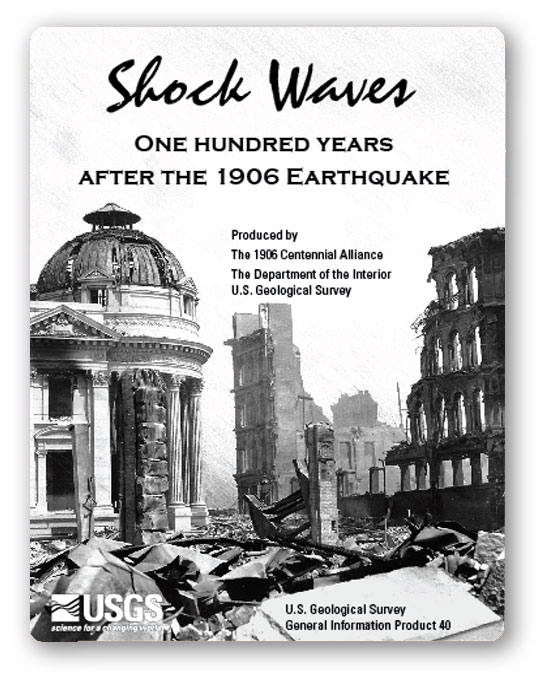


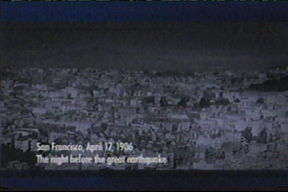
Shock WavesOne Hundred Years After the 1906 Earthquake
Get Flash Player (free
download) to view this movie.
Full Program URL:Earthquake
Hazards Program Shock Waves
Description:
This 46-minute film includes dramatic historical
footage, colorful animations, and interviews with earthquake experts. The
catastrophe of the great 1906 quake spurred a century of progress in earthquake
science and engineering. Current and future research includes drilling through
the San Andreas Fault at depth in the SAFOD Experiment. Learn what you can do to reduce the risk to yourself and family.
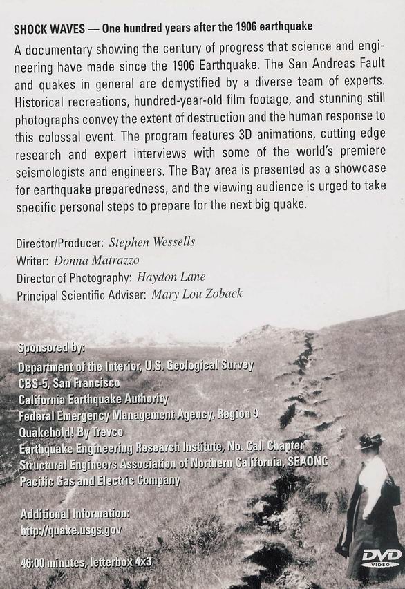
Shock Waves received numerous industry awards including recognition as an outstanding documentary at the 2006 Telly Awards and was nominated for a regional Emmy Award in the Bay. It aired twice on KPIX CBS5 and its affiliate station around the time of
the April 18, 2006, 100-year anniversary of the Great San Francisco Earthquake.
Misc. related links (Note, you will be leaving the MDSHS website. Use the "back" button to return. )
1906 Earthquake Centennial Alliance:
http://1906centennial.org/
Atlas of maps and seismograms accompanying the report of the State Earthquake Investigation Commission upon the California earthquake of April 18, 1906. Andrew C. Lawson, G.K. Gilbert, H.F. Reid, J.C. Branner, A.O. Leuschner, George Davidson, Charles Burckhalter, W.W. Campbell. Carnegie Institution of Washington. Washington, D.C. 1908. (seal) Carnegie Institution of Washington 1902.
Complete Atlas |
Title Page |
Contents of Atlas
Selected Maps from the Atlas of triangulation surveying interest:
Map # 24 - Map of Coast Range regions of Middle California showing distribution of earth movement on April 18, 1906, as revealed by displacement of triangulation stations of the Coast and Geodetic Survey, as determined by resurvey, 1906-1907.
Map #25 - Distribution of the earth movement on April 18, 1906 and in 1868, as revealed by displacement of triangulation stations of the Coast and Geodetic Survey, as determined by resurvey in 1906-1907
One Hundred Years After the 1906 Earthquake
Get Flash Player (free
download) to view this movie.
Full Program URL:Earthquake
Hazards Program Shock Waves
Description:
This 46-minute film includes dramatic historical
footage, colorful animations, and interviews with earthquake experts. The
catastrophe of the great 1906 quake spurred a century of progress in earthquake
science and engineering. Current and future research includes drilling through
the San Andreas Fault at depth in the SAFOD Experiment. Learn what you can do to reduce the risk to yourself and family.
Shock Waves received numerous industry awards including recognition as an outstanding documentary at the 2006 Telly Awards and was nominated for a regional Emmy Award in the Bay. It aired twice on KPIX CBS5 and its affiliate station around the time of
the April 18, 2006, 100-year anniversary of the Great San Francisco Earthquake.
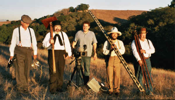
Click here to see screen shot photos of MDSHS members on film.
MDSHS is a California non-profit corporation organized under
IRS 501(c) 3 (Federal #8916806802, CA 1835904).
Website designed by and maintained by Michael J. Foley, PLS
Page last edited, March 24, 2013
Copyright © 2013 MDSHS
www.mdshs.org