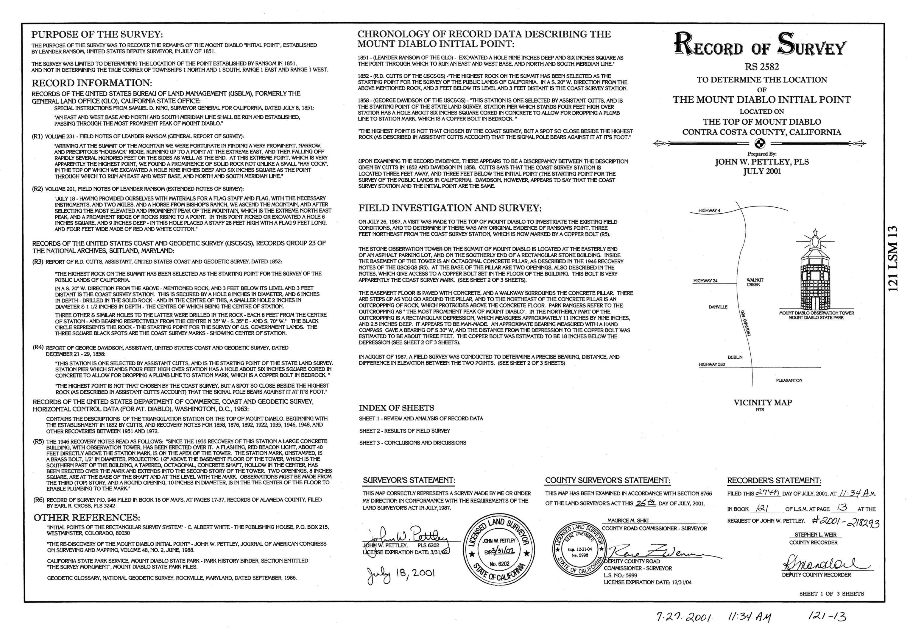
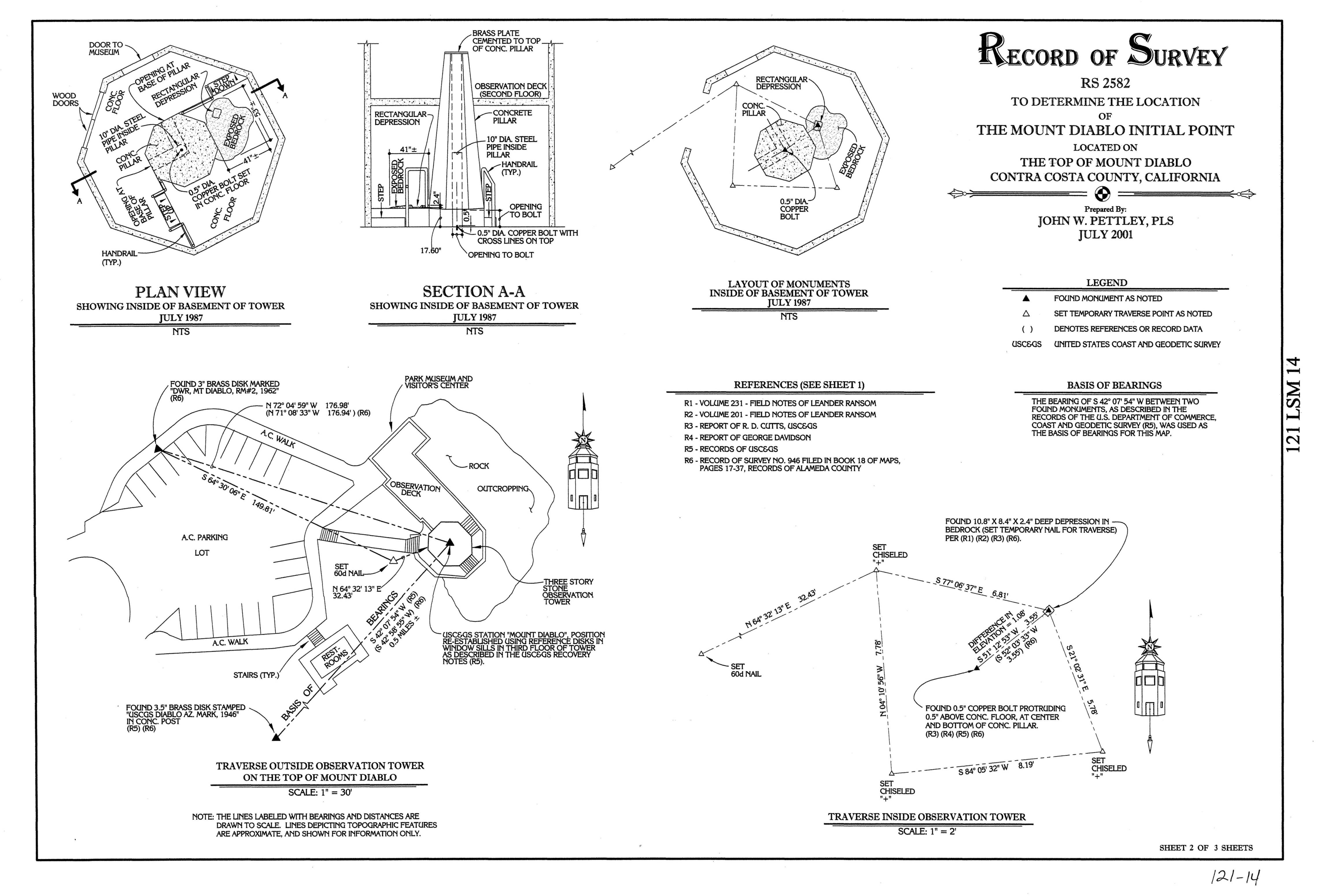
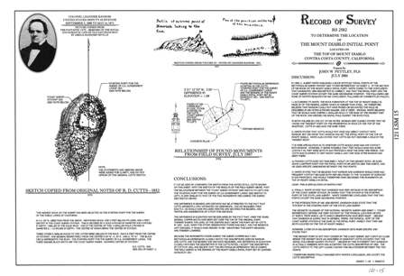
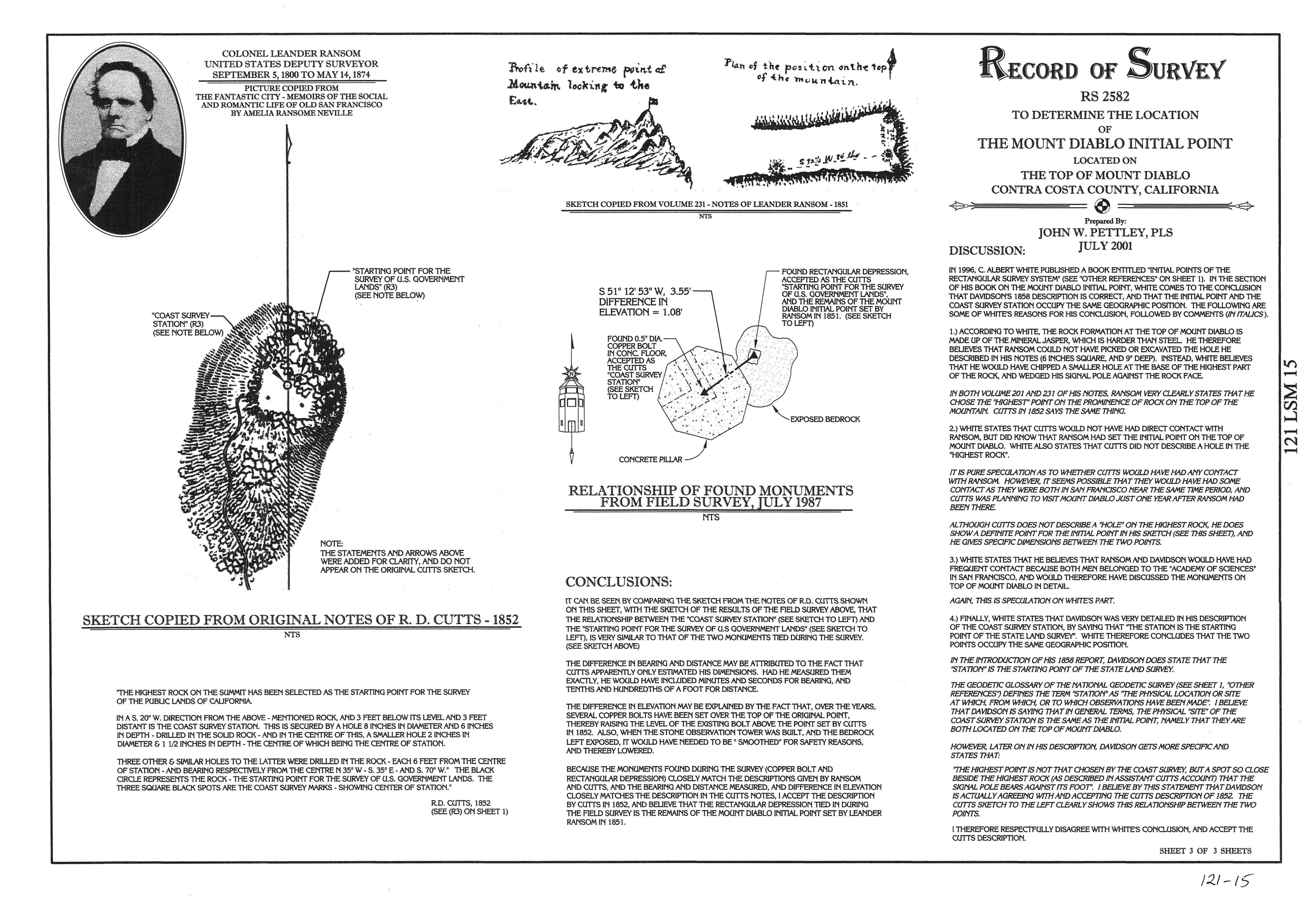
Record of Survey
RS 2582
To Determine the Location
of
The Mount Diablo Inital Point
Located On
The Top of Mount Diablo,
Contra Costa County, California
Prepared By:
John W. Pettley, PLS
July 2001
Please scroll down to view photos.
These photos have be reduced to allow this page to load
faster... Click on Sheet number to load larger image.


To down load a copy of this map sheet in PDFclick here
To down load a copy of this map sheet in PDFclick here
To down load a copy of this map sheet in PDFclick here
This map of survey was filed on the 27th day of July, 2001, in Book 121 of Land Surveyors Maps (L.S.M.) at pages 13-15, Official Records of Contra Costa County, California and is therefore a part of the public record. The map may be freely distributed, however the content of the map is protected by Copyright (C) 2001 John W. Pettley, PLS, all rights reserved.
(Note: The opinions expressed on the survey do not necessarily reflect the opinions of the Mount Diablo Surveyors Historical Society. The author is solely responsible for its content.)