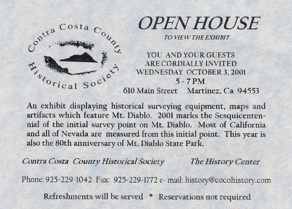
To view larger image of this invitation, click here.
Please scroll down to view photographs of this event...
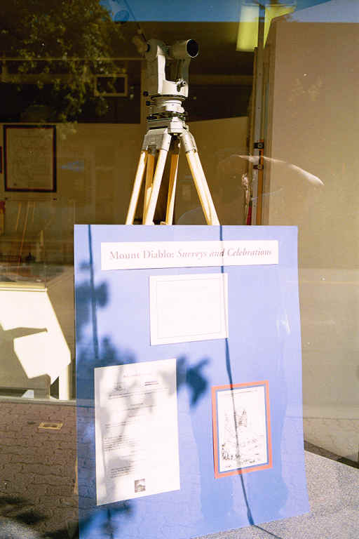
Mount Diablo: Surveys and Celebrations
U. S. Deputy Surveyor, Colonel Leander Ransom (1800-1874).
"Township Plats" at the summit of Mount Diablo.
This exhibit was created as a partnership between the Museum of the San Ramon Valley,
Mount Diablo Surveyors Historical Society and the Contra Costa County Historical Society.
This Exhibit is a sub-set of the "Mount Diablo: Surveys and Celebrations" exhibit
of the 150 year Celebration of the establishment of the Mount Diablo Initial Point
that was on display at the Museum of the San Ramon Valley, Danville, CA
from June 1 to July 28, 2001. To visit that display event page, follow this link
Mount Diablo: Surveys & Celebrations
(Be sure to hit the "Back" button to return to this page.)

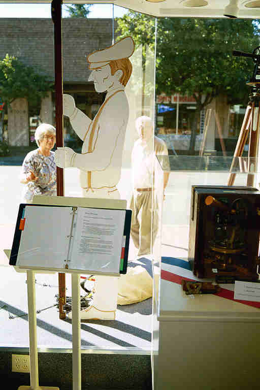
Rodney the Rodman (l) and Sam the Surveyor (r) hard at work transferring elevations
on Main Street in downtown Martinez, CA.
(Their last job was running levels at the Museum of the San Ramon Valley, Danville, CA!)
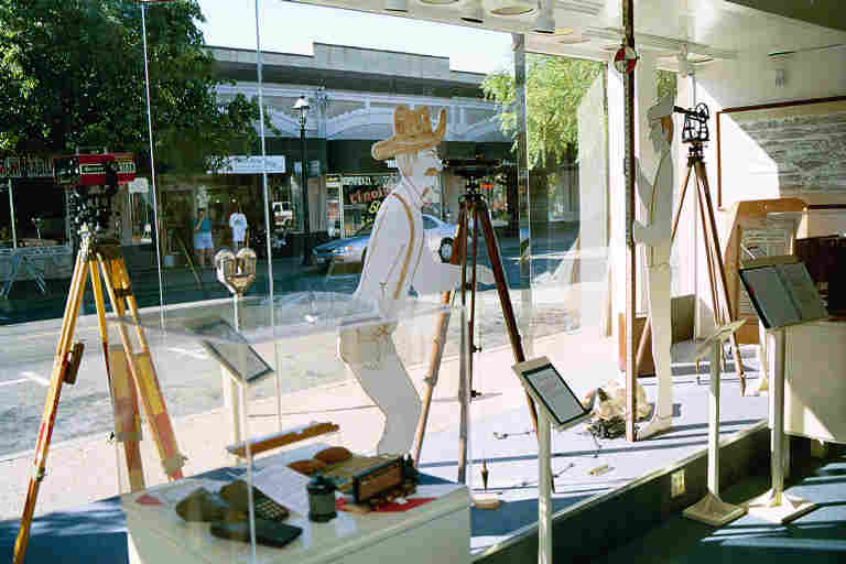
Sam the Surveyor takes aim looking through his dumpy level at
Rodney the Rodman holding a Philadelphia leveling rod with target.
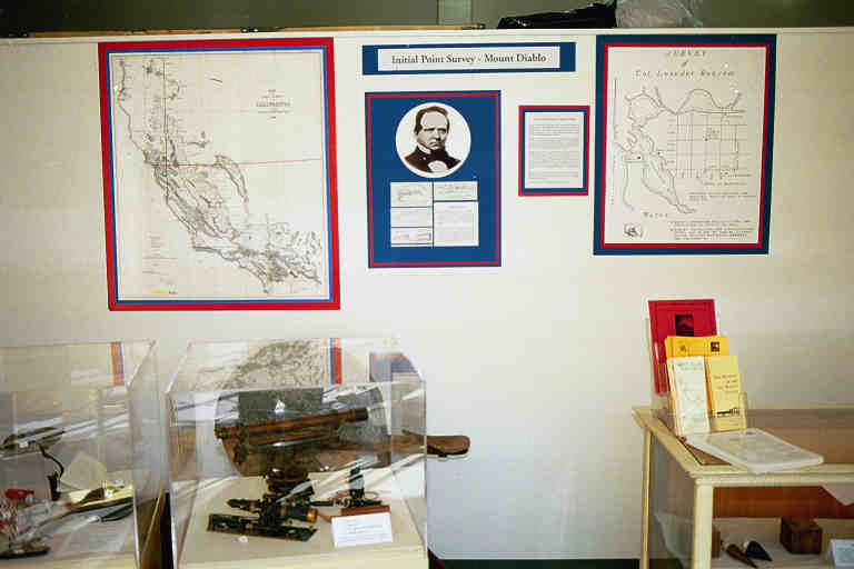
The display showcased Ransom's efforts to establish the Mount Diablo Initial Point
on the summit of Mount Diablo on July 17, 1851
and the running of the Mount Diablo Meridian and base line.
T1N, R1W, MD.
T1N,R1E, MD.
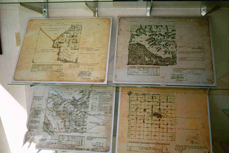
T1S, R1W, MD.
T1S, R1E, MD.
To learn more about these Township Plats, visit our maps page.
(Be sure to hit the "Back" button to return to this page.)
This display was mounted by Beverly Lane of the Museum of the San Ramon Valley (MSRV) along with Don Foley and Michael Foley of the Mount Diablo Surveyors Historical Society (MDSHS). MDSHS members Jim Stein and Ray Zwemmer participated as docents for this exhibit. MDSHS members Duncan Marshall and Hal Davis helped to dissemble of the exhibit. Photographs by Michael Foley, ©2001 MDSHS. All rights reserved.
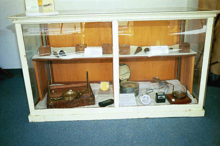
Top shelf: Various survey monuments and plumb-bobs.
Bottom shelf: Surveyors "plain" magnetic compass, hand held GPS receiver,
aneroid altimeter/barometer, magnetic dipping needle or miner's compass,
Aqua® valve box locator,"Brunton" style pocket transit (compass) and surveyors compass.
(described from left to right)
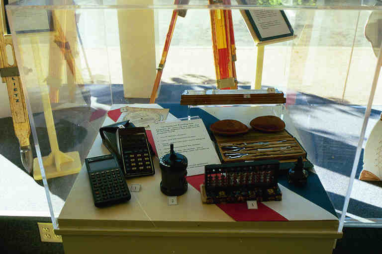
Electronic hand held calculators (HP48SX®, HP35®),
COX's stadia computer, "CURTA" handheld mechanical calculator, abacus, drafting set.
(described from left to right)
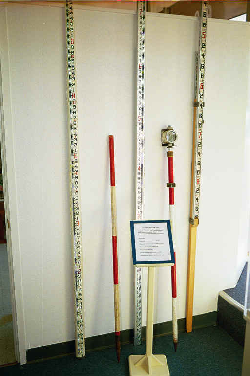
25-foot telescoping fiberglass leveling rod, 4-foot red-white "range" pole,
10-foot 2-piece leveling rod, "EDM" retro-prism on telescoping rod,
LENKER "L-E-VATION"® direct reading leveling rod.
(described from left to right)
MSRV's Beverly Lane(l) and MDSHS's Don Foley(r), give the exhibit the
final look over from Main Street while Rodney the Rodman holds steady.
"Looks good, were done!"
IRS 501(c)3 (Federal #8916806802, CA#1835904).
Website designed by and maintained by Michael J. Foley, PLS
Page last updated 02/28/2013
Copyright ©2013 MDSHS.
http://www.mdshs.org