The Mount Diablo Surveyors Historical Society
** BETA - WEB PAGE IN DEVELOPMENT **
(To Table of Contents)
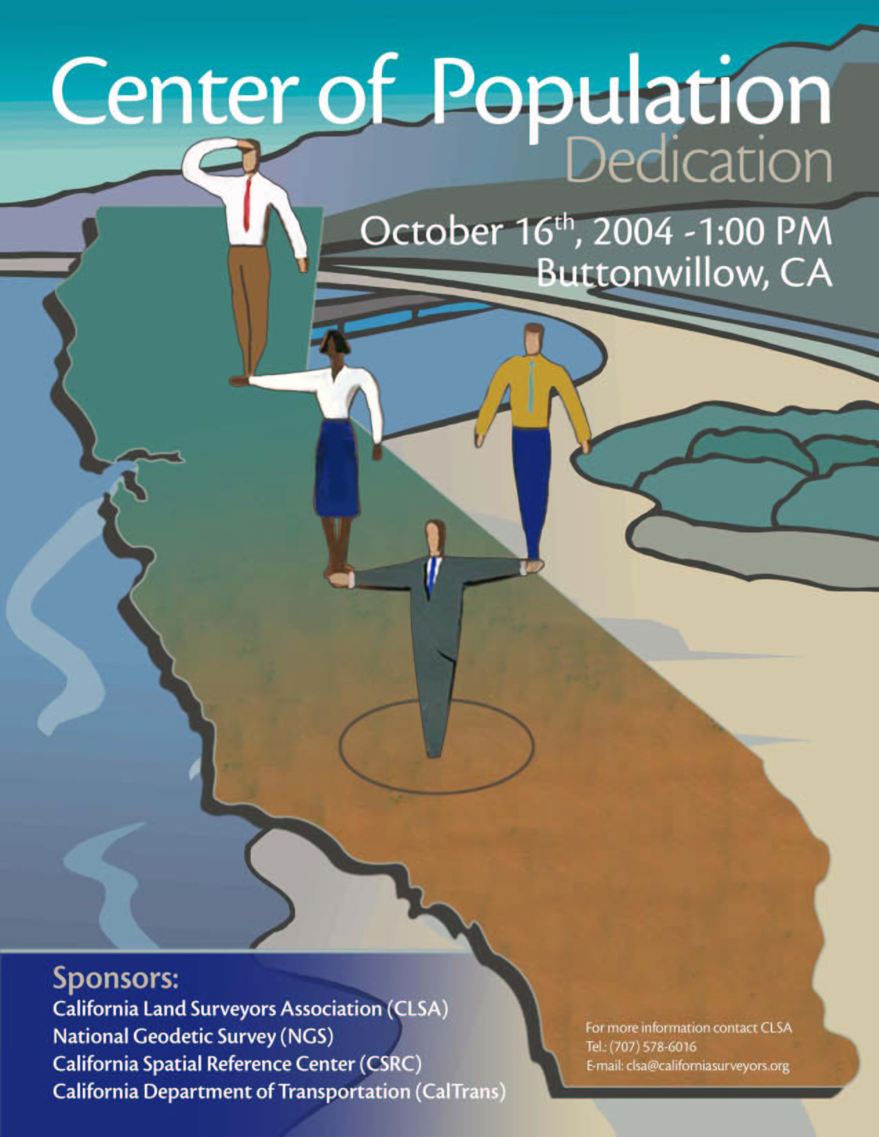
California's Center of Population Dedication
How California's Western Kern County became the State's "center of population".
Event Sponsered by:
California Land Surveyors Association, National Geodetic Survey, California Spatial Reference Center and the California Department of Transporation; with support from the Bakersfield Chapter of the California Land Surveyors Association and the Mount Diablo Surveyors Historical Society
Buttonwillow Rest Area, southbound Interstate 5, Buttonwillow, Kern County, CA
October 16, 2004
Table of Contents
Introduction
Background: The U.S. Census Bureau recently completed the compilation and analysis of the 2000 decennial census data. Until the completion of this analysis not many people had ever heard of Buttonwillow, California. Buttonwillow, an agricultural community located approximately 30 miles west of Bakersfield near the junction of State Highway 58 and Interstate 5, has become known as California’s “Center of Population”.
What is the Center of Population?
If you put the entire California population of 33,871,648 on a teeter-totter, the Center of Population would be the balance point, assuming California was flat and everyone weighed the same. This is many miles from the state’s geographic center and has a special significance. The Center of Population is an indication of where the State is headed.
The California Land Surveyors Association (CLSA), in cooperation with the National Geodetic Survey (NGS), California Spatial Reference Center (CSRC), and California Department of Transportation (CalTrans) have set a commemorative geodetic control monument at the Buttonwillow roadside rest area along southbound Interstate 5 in Kern County.
To commemorate this event, a dedication ceremony was held at the monument site on October 16, 2004 at 1:00 PM. This event provided an opportunity to showcase improvements in Global Positioning System (GPS) technology, the adaptation of that technology by Land Surveyors, and the ability to develop cooperative initiatives between the private sector, federal, state and local surveying and mapping professionals.
|
California's Center of Population Monument
By Mark S. Turner, PLS
Where are all the people and why are they moving?
Imagine, if you will, a kind of pre-Columbian worldview in which the earth and particularly California is a flat, rigid, weightless surface. Moreover, think of the state's entire population with each of the 35 million people weighing exactly the same.
Where, Then, Would the Perfect Balance Point Be?
Ironically, in a cotton field amid the vast open tracts of western Kern County is the imaginary balance point used to analyze (California's) population distribution and change.
According to the 2000 census, the "center of the population" (COP) for America's most populous state lies, ironically, in a cotton field between the communities of Shafter (pop. 13,700) and Buttonwillow (pop. 1,300) amid the vast open tracts of western Kern County. It is a surrealistic concept, but true.
The next question becomes, "How do experts determine the location of this center of population and why is it so important to demographers, surveyors, engineers, planners, the geophysical community, the business community and local officials?"
Why Is This Important?
Modern society increasingly needs accurate and reliable geographic data for making critical decisions in such varied activities as environmental monitoring, the effects of urbanization, flood plain management, civil infrastructure management, earthquake research, and emergency response. Organizations and individuals are working together to develop systems to meet today's spatial referencing needs.
Business leaders and local officials have also realized the COP's significance. Many large warehousing and manufacturing operations in Kern County are within a 40-mile radius of the COP and are strategically positioned to distribute products around the state. The 1880 center of population in San Joaquin County is now home to large operations serving major Northern California population centers.
"So What?" Some Might Ask
One reason is simply to showcase improvements in Global Positioning System (GPS) technology, its adaptation by land surveyors, and the developing cooperation between federal, state, local, and private surveying and mapping professionals.
On October 16, 2004, local officials joined the project sponsors and members of the Bakersfield Chapter of the California Land Surveyors Association and the Mount Diablo Surveyors Historical Society to dedicate a COP monument at the median island of the Buttonwillow Rest Area, approximately 30 miles west of Bakersfield, along southbound Interstate 5 (two miles north of Highway 58).
What better way is there to educate citizens about land surveying and the unique and powerful forces that "move and shake" California's population?
How the 'COP' Is Determined
Not to be confused with California's geographic center - 118 miles north in Madera County - the center of population is the imaginary balance point used to analyze population distribution and change. In simple terms, it is the single point that is closest to all the people in the state.
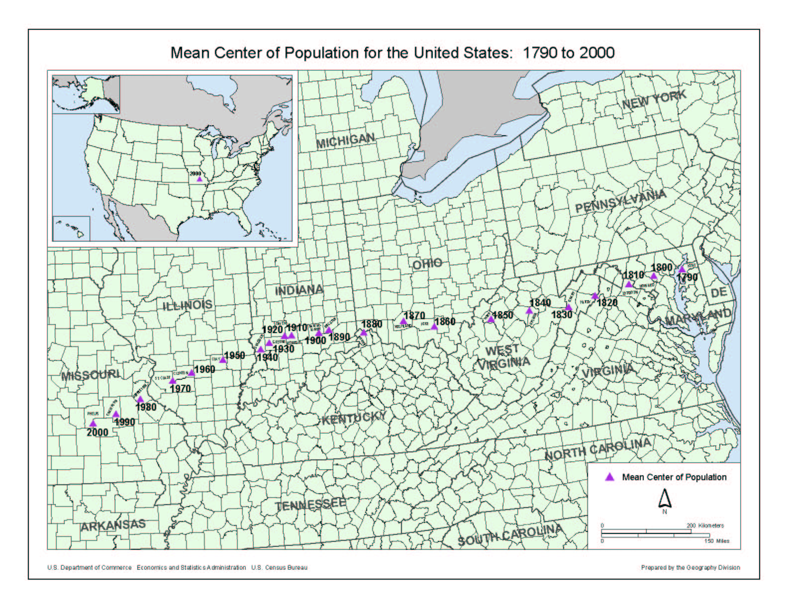
To calculate the center of America's population, the U.S. Census Bureau compiled and analyzed 2000 census data and computed coordinates for the point that had the shortest distance to the centers of all of the census tracts. The result is a latitude and longitude that can be shown on a map and can be physically located on the ground. The Census Bureau has kept these statistics for California since 1880.
Mean Center of Population for the United States: 1790-2000
Click here for a full size image
In addition to the national goal of marking each state's COP, a survey monument rests at the nation's center of population, Phelps County, Missouri.
One thing is clear: California has had an unmistakable influence on the nation's COP through the decades. Even though California's COP has remained in Kern County for 70 years, its pull on the nation's population center remains a steady and powerful force.
An examination of California's COP from 1880 to 1960 shows a predictable shift to the southeast. Southern California's population grew rapidly, drawing the center toward Los Angeles. Interestingly, the movement of the state's population center over the decades since 1880 roughly follows the alignment of Interstate 5 and the California Aqueduct, two major arteries constructed to accommodate the state's growth.
Between 1960 and 1990, the COP stabilized, shifting slightly more toward the east. Between 1990 and 2000, the center began to slide to the northeast, reflecting the population growth in Northern and Central California, especially along Highway 99.
Surveyors' Involvement
As the state's population has grown, its transportation needs have broadened over the last century. Surveyors make up the one profession that links all the elements of a transportation project: from conception to planning, through design, land acquisition, construction, final monumentation, and map recordation.
Surveyors provide relevant data about the shape, contour, location, elevation, or dimension of land features. Therefore, the COP - a single, tangible point in space - can grab the public's attention. It can also provide a valuable surveying monument for the National Spatial Reference System (NSRS). The NSRS provides a consistent coordinate system that defines latitude, longitude, height, scale, gravity, and orientation throughout the United States.
Surveyors from Caltrans District 6 (Fresno) and the California Land Surveyors Association worked to design and place the monument in a suitable location. In a collaborative venture, Condor Earth Technologies made the surveying measurements, under contract with the California Spatial Reference Center. The monument is now part of a network of more than 100 stations in the San Joaquin Valley Height Modernization Project, developed to obtain new or updated horizontal coordinates and heights (elevations).
Using Global Positioning System (GPS) technology, surveyors performed observations at the monument over two days, collecting data an hour each day to meet project requirements. Additional observations ensured that the survey monuments achieved a positional accuracy of one to two centimeters horizontally and two to five centimeters vertically, relative to other NSRS stations in the vicinity. The California Spatial Reference Center is processing the data, and expects the National Geodetic Survey to approve it for inclusion in the National Spatial Reference System (NSRS) database.
Crustal Motion and Subsidence
Establishing coordinates on surveying monuments in California requires considering the movement of the earth's crust. Powerful tectonic forces shape California's diverse and beautiful landscape. The state is torn between the North American Plate and the Pacific Plate. Generally, the split occurs along the San Andreas Fault.
Creeping motion at the junction of these plates can cause the earth's crust to warp as much as five centimeters a year. In addition, earthquakes can result in horizontal displacements of as much as five meters, such as the 1992 Landers earthquake. The Cape Mendocino temblor that same year caused a vertical displacement of more than a meter.
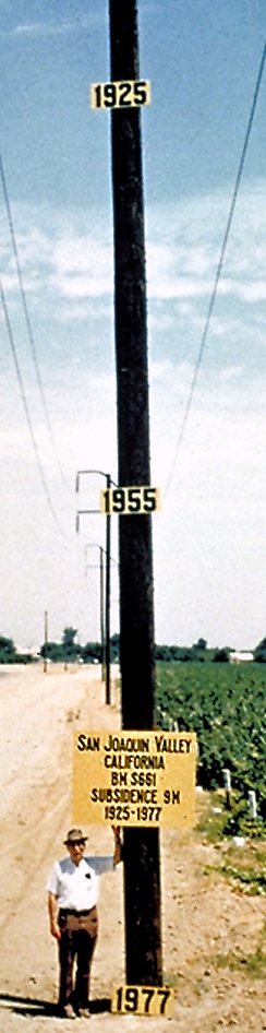
Many areas of the state (Central Valley, Lancaster/Edwards Air Force Base, and Long Beach) also experience land subsidence, or sinking, due to water, oil or gas extraction. A benchmark near Mendota in the San Joaquin Valley had a measured subsidence of 24 feet between 1943 and 1966. The elevation is unknown today because the benchmark no longer exists.
With the advent of GPS surveying and improvements in measurement technology, land surveyors now require more accurate coordinates for geodetic control. Geodetic surveying takes into account the shape and size of the earth to determine horizontal and vertical positions. The National Geodetic Survey, in conjunction with partners such as Caltrans, has been remeasuring and refining the coordinate system.
In addition, GPS allows surveyors to establish both horizontal coordinates and heights on the same geodetic marker. Getting accurate heights using GPS requires proximity to the historical benchmarks as well as stringent observation techniques. This commemorative monument is unique among the states because it is the only one, thus far, that has both horizontal and vertical values.
Where Do We Go from Here?
California's population has increased dramatically over time. The state is home to more than 36 million people, a 16 million increase in 30 years. It took 100 years to reach the 10 million mark. Since then, California has been adding 10 million people every 20 years.
Will future census data show that transportation has had an impact on the inevitable population shift? Or will the population shift have an impact on transportation? By 2010, barring major earthquakes in the area, the 2000 COP itself is predicted to move about one foot in a northwesterly direction.
Whatever the future holds, California's professional surveyors will be back to set and measure another commemorative survey mark for Californians to contemplate and enjoy.
California's COP project was co-sponsored by the California Land Surveyors Association, U.S. Census Bureau, National Geodetic Survey, California Spatial Reference Center, and California Department of Transporation. (Caltrans)
Dr. Joe Poland stands next to a benchmark
showing area land subsidence from 1925-1977.
Photo courtesy of the U.S. Geological Survey
Article By Mark S. Turner, PLS., Chief, Office of Land Surveys,
Caltrans Division of Right of Way and Land Surveys. First published in Volume 1, Issue 2 (2005) California Transportation Journal. Used with permission, California Department of Transportation. http://www.dot.ca.gov/docs/CTJ_v1_iss2.pdf
Photos still needed:
A sign welcoming travelers to Buttonwillow
Surveying equipment with the photo caption: Using a variety of equipment, Caltrans surveyors perform a number of tasks from keeping track of the earth's seismic movements to measuring the rising and falling of its crust. Recently, they even helped to determine the state's "center of population."
|
(TOC)
Please scroll down to view photographs of this event/exhibit...
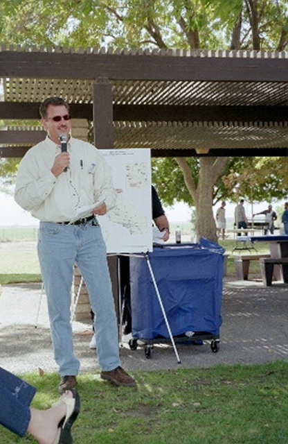
Photograph #1

Commemorative geodetic control monument with MDSHS Display in background
(TOC)
Photograph #2
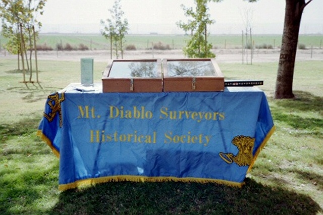
MDSHS Public Display
(TOC)
Defination of "Monument": Anything by which the memory of a person, thing, idea, art, science or event is preserved or perpetuated
In real-property law and surveying, monuments are visible marks or indications left on natural or other objects indicating the lines and boundaries of a survey. Any physical object on ground which helps to establish location of boundary line called for; it may be either natural (e.g. trees, rivers, and other land features) or artifical (e.g. fences, stones, stakes or the like placed by human hands). Blacks Law Dictionary, Sixth Edition, pgs 1007,1008 |
Photograph #3
Photograph #4
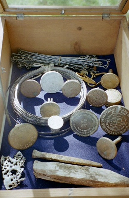
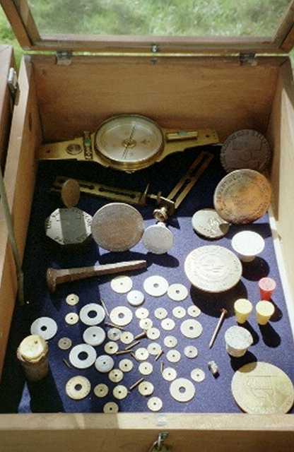
| One of the main themes of this event was the recognition of the establishment of the monument representing the center of population; therefore the MDSHS display was comprised of many types of monuments to demonstrate to the public that there are more then one type of survey monument. |
(TOC)
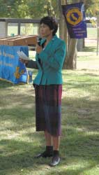
| Speaker Robert C. Hart, PLS, CLSA President welcomes everyone in his opening remarks. |
Photograph #4a
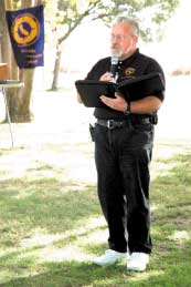
Photograph courtesy of California Surveyor
©2004 California Land Surveyors Association.
(TOC)
Photograph #5
| Don D'Onotrio, NGS Geodetic Advisor to California (Ret.) explains NGS's role in the monumentation project. |
(TOC)
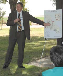
Photograph #6
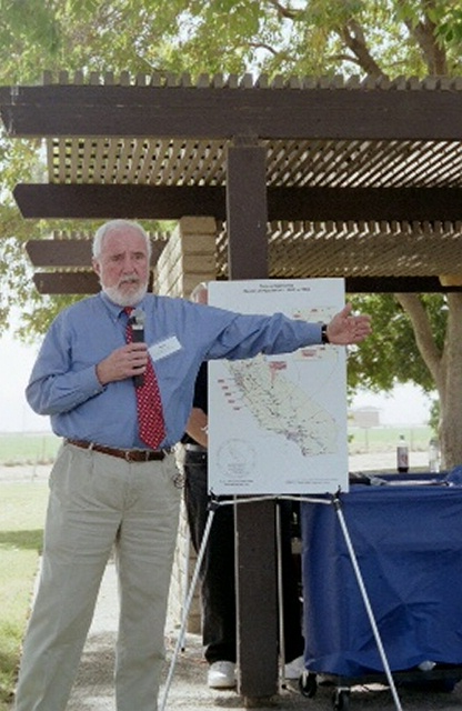
| Mark S. Turner, PLS., Chief, Office of Land Surveys,
Caltrans Division of Right of Way and Land Surveys explains to the audiance what Caltrans role is in the Center of Population Monumentation Project. |
(TOC)
Photograph #7b
Photograph courtesy of California Surveyor
©2004 California Land Surveyors Association.
(TOC)
| A representitave from the U.S. Census Bureau describes the mission of the bureau in tracking the nations population and how thier studies have shown population growth and migration movements on both the national and state levels |
Photograph #7c
Photograph courtesy of California Surveyor
©2004 California Land Surveyors Association.
(TOC)
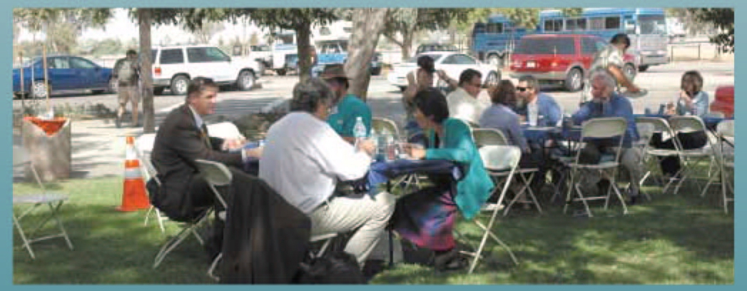
| A BBQ lunch prepared by the Bakersfield chapter of the California Land Surveyors Association was enjoyed by all. |
Photograph #8
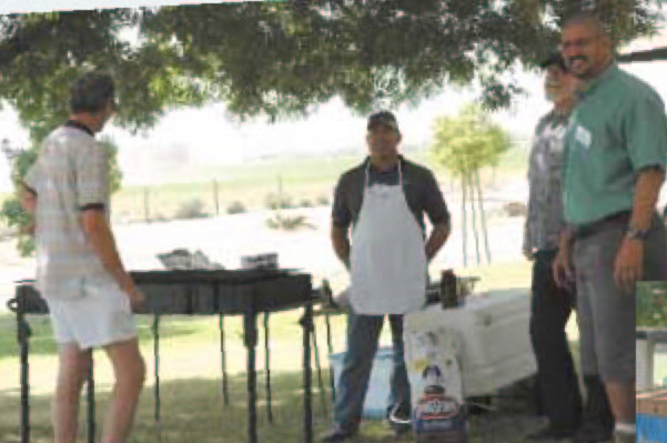
(l-r) Randall Smith, Roland VanDeValk, Robert Mills, and Sam Walker.
Photograph courtesy of California Surveyor ©2004 California Land Surveyors Association.
Photograph #8a
Photograph courtesy of California Surveyor ©2004 California Land Surveyors Association.
(TOC)
| The Center of Population Monument installed by Caltrans District 6 (Fresno) Crew June 17, 2004. |
Photograph #9
Photograph courtesy Darrell G. Bain, Senior Transportation Surveyor, Caltrans.
(TOC)
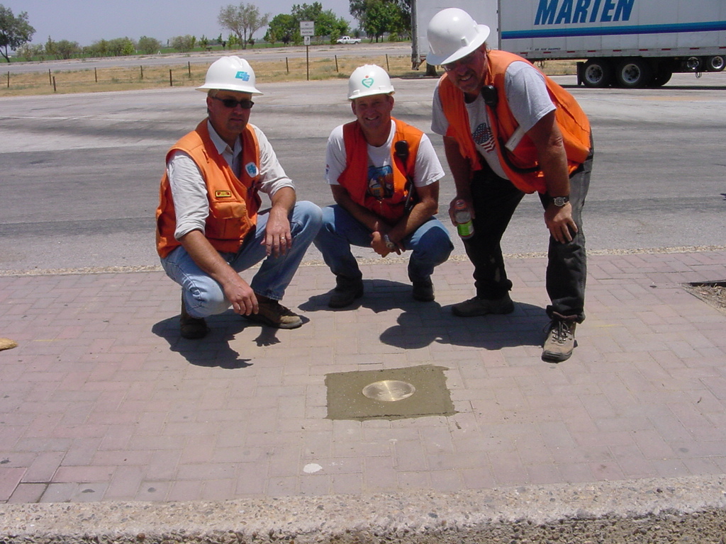
Close up of the Center of Population commemorative monument in place.
Photograph #10
Photograph courtesy Darrell G. Bain, Senior Transportation Surveyor, Caltrans.
(TOC)
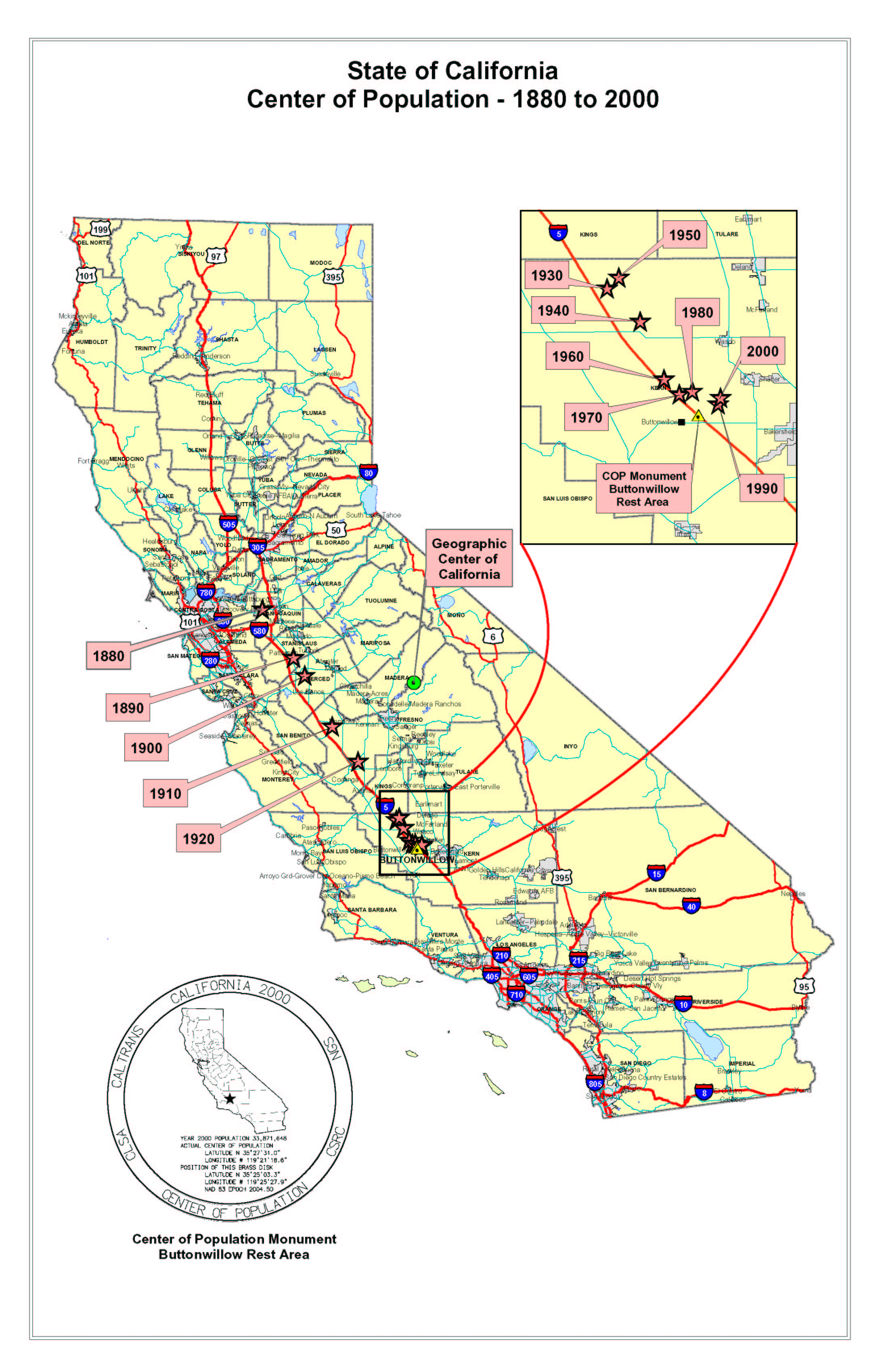
| Map showing the progression of California Center of Population, 1880-2000 beginning in 1880 in northern central California near Stockton in western San Joaquin County and currently (2000) in southern central California near Buttonwillow in western Kern County. |
Photograph #11
(TOC)
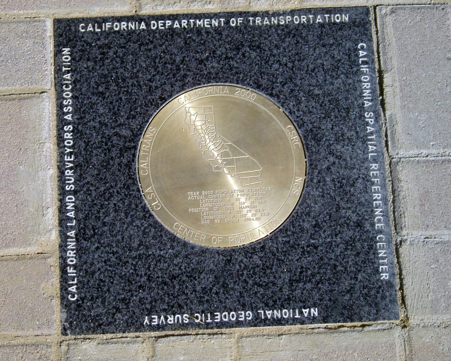
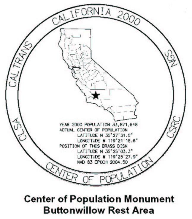
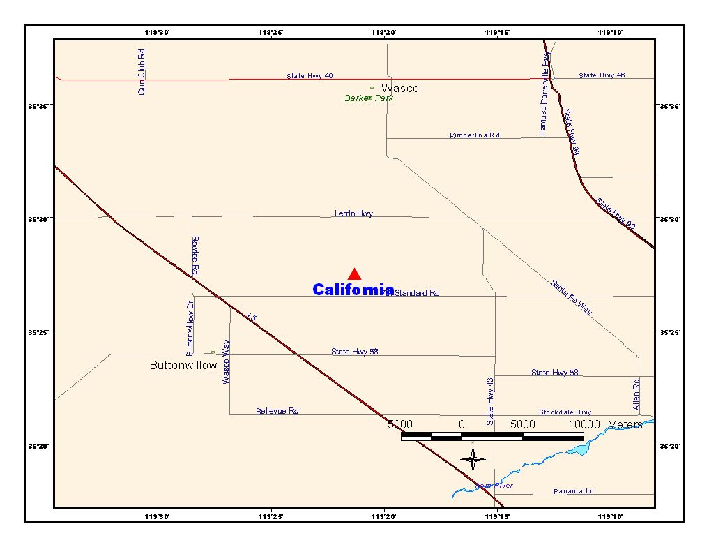
Center of Population Monument
Final Survey Values.Latitude N 35° 25' 03.3" Longitude W 119° 25' 27.9"
Photograph #12
(TOC)
Link to NGS DATASHEET for COP Monument
To see a cached version of the National Geodetic Survey's Datasheet for this monument,
click here. (Note: for the current Datasheet, visit the NGS Datasheet page for PID = "DH6647"
(TOC)
Actual Center of Population
Latitude N 35° 27' 31.0" Longitude W 119° 21' 18.6" |
Photograph #13

(TOC)
|
This display was mounted by Michael J. Foley of the Mount Diablo Surveyors Historical Society. Unless otherwise noted, photographs by Michael J. Foley, PLS, ©2004 MDSHS. All rights reserved. |
Related external links.
Epilogue
|
California Center of Population is on the Move!
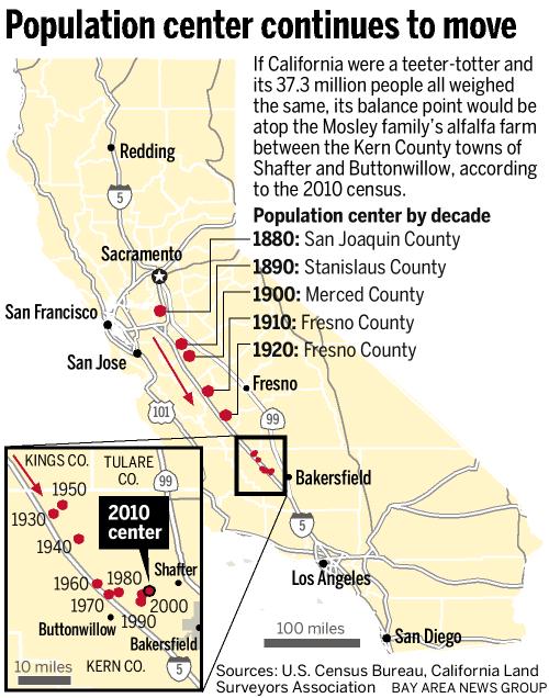
After more than a century of heading south, tugged by the blossoming of Los Angeles from a town of a few thousand people to a metropolis of millions, the point has been stuck for decades in Kern County, teetering south in some decades, tottering north in others. The new 2010 census figures show that it has moved 1.7 miles northeast since the previous count in 2000 (Latitude N 35° 27' 31" Longitude W 119° 21' 19").
California Center of Population - 2010 Census.
Latitude N 35° 27' 49" Longitude W 119° 19' 31"
Source: U.S. Census
To read an on-line article about the history of the movement of the center of population in California published Sunday, April 17, 2011 in the Contra Costa Times; California's population center is in an alfalfa field
click here
For a larger map image, click here
(TOC)
Epilogue II

California 2010 Center of Population [Monument] Dedication Ceremony
October 19th, 2013 - 3:30 PM,
Shafter Depot Museum
150 Central Valley Hwy.
Shafter, CA
Click here for full details
(TOC)
|
MDSHS - Mount Diablo Surveyors Historical Society
A California non-profit public benefit corporation organized under
IRS 501(c) (3) (Federal #8916806802, CA 1835904).
Website designed by and maintained by Michael J. Foley
Page last updated October 10, 2013
Copyright ©2013 MDSHS
http://www.mdshs.org
|
