The Mount Diablo Surveyors Historical Society
Sponsored by the
July 19, 2011 to Current
|
This display was set up to educate the public about the United States Public Land Survey System (PLSS) as a joint venture with the Santa Clara County Archivist's office. Trista Raezer is the County Archivist. This office is in / under the County Clerk - Recorder's Office. Update: On May 25, 2012 Trista Reazer left the county employment to take another position outside the county. The county did not replace the position of County Archivist. The County Archives are now under the County Clerk's Office, and they took over the responsibilities of the Archives, effective July 12, 2012. Contact information shown here is current otherwise. |
To learn more about the Santa Clara County Archives visit their web page here:
http://www.sccgov.org/sites/ceo/County%20Archives/Pages/Santa-Clara-County-Archives.aspx
Please scroll down to view photographs of this event/exhibit...
Short History of PLSS.
Location / Directions
Display Location
Map of PLSS of US.
The Full Display
Britton & Rey's Map of CA
Exhibit Change
Surveyors Vernier Compass
Township Plat
Mt. Diablo Initial Point
Re-elect Co. Surveyor
Bearing Tree, Wood Post Monument
Transit with "Solar Attachment"
Engineers Link Chain
Surveyors Link Chain
Event Credits
Bottom of the page.
Short History of the U.S. PLSS.
|
The Public Land Survey System (PLSS) is a way of subdividing and describing land in the United States. All lands in the public domain are subject to subdivision by this rectangular system of surveys, which is regulated by the U.S. Department of the Interior, Bureau
of Land Management (BLM). The PLSS was begun shortly after the Revolutionary War, when the Federal government became responsible for large areas west of the Thirteen Original Colonies. The transfer of this Federal land to private citizens became an urgent matter for several reasons: land had been promised to the impoverished soldiers of the Continental Army for their service, the indebted Government needed to tap the land's potential to provide sorely needed revenue, and the land held great promise for the future of the young Nation. Because of these pressing concerns, the Government needed a methodical process for dividing the western frontier among the people it served. In response to this need, the U.S. Congress adopted the system of surveys that became what we know as the PLSS. In the western United States, the PLSS is the basis for most land transfers and ownership today. Land management agencies use the PLSS to describe legal land locations. Federal agencies involved in surface and mineral management require the use of PLSS terminology in their day-to-day actions. Additionally, many agencies dealing with natural resource or environmental databases use PLSS boundaries for georeferencing. The PLSS is a rectangular survey system that typically divides the land into 6-mile square townships, which are further subdivided into 1-mile square sections. This map layer, compiled by the U.S. Geological Survey, contains PLSS boundaries to the township level. The PLSS is found in the following States: Alabama, Alaska, Arizona, Arkansas, California, Colorado, Florida, Idaho, Illinois, Indiana, Iowa, Kansas, Louisiana, Michigan, Minnesota, Mississippi, Missouri, Montana, Nebraska, Nevada, New Mexico, North Dakota, Oklahoma, Ohio, Oregon, South Dakota, Utah, Washington, Wisconsin, and Wyoming. For further historical information and for data to the section level and beyond, see the BLM Land Survey Information System page. |
| To learn more about the United States Public Land Survey System click here or click on the logo. |
The above information was taken from the NationalAtlas.gov™ web site:http://nationalatlas.gov/index.html
Location / Directions
| The display is located at Santa Clara County Archives Facility. Located at 1875 Senter Road, San Jose, CA. From the "T" intersection of Senter Road with Needles, proceed southwesterly along driveway. NEW: The parking lot in front of the Archives is now visitor parking. Parking is free. Additional parking area 525 feet +/- to the facilities / archives office, on your left / southerly side. |
Photo #1
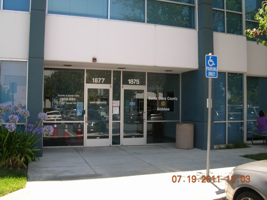
| The Archives office hours are: Open Mondays and Wednesdays from 9 am to 1 pm. (Suggest call first to confirm open hours.) Plus by appointment from 9 am to 1 pm on Tuesday, Thursday and Friday. Call 408.755.7895 for appointments. |
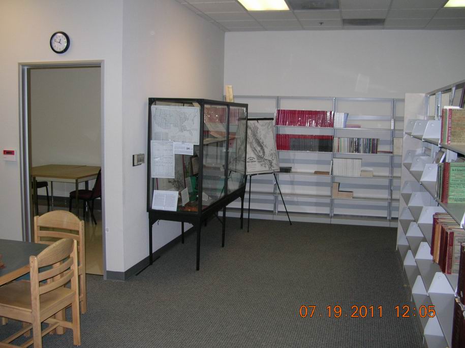
Display Location
Photo #2
Map of the Public Land Survey System of the United States.
| The rectangular survey system, which was first proposed by Thomas Jefferson and enacted into law by the Land Ordinance of 1785, forms the backbone of the Nation's land surveys. As a young nation, we faced the daunting task of surveying over 1.8 billion acres of public domain lands acquired through the Louisiana Purchase, the Alaska Purchase, and other acquisition actions. This map shows the segregation between the original Colony States from the Public Lands States. |
Photo #3
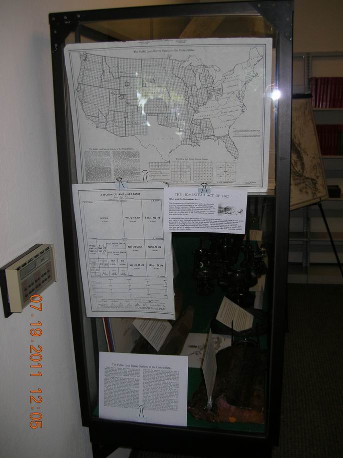
Diagram showing the breakdown of a typical Section of Land- 640 Acres.
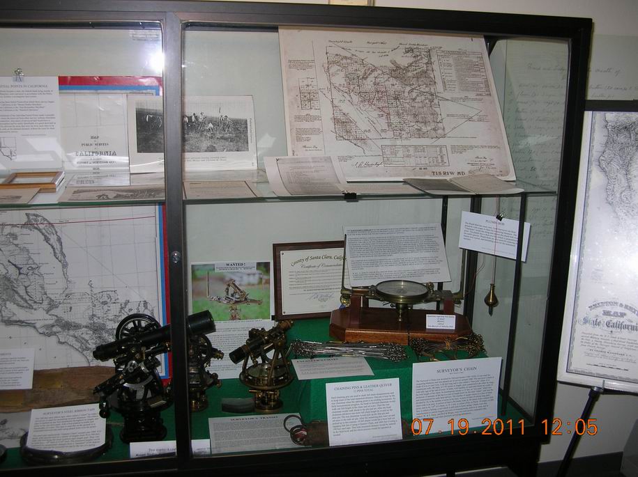
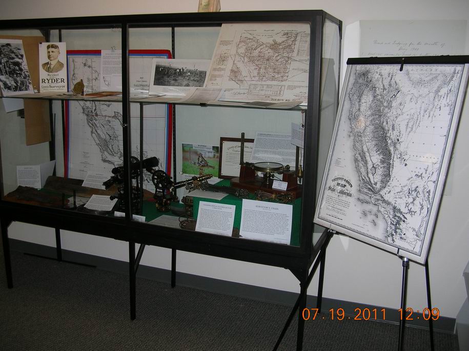
The Full Display
Photo #4 Photo #5
Britton & Rey's Map of the State of California
Photo #6
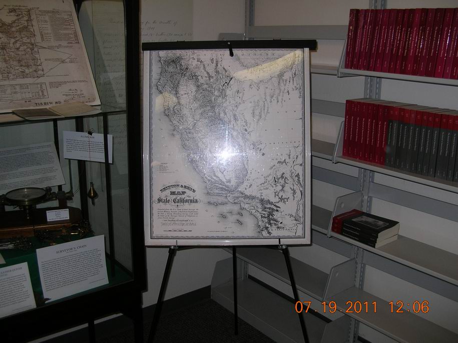
| Britton & Rey's Map of the State of California. Compiled from the U.S. Land & Coast Surveys, the several, Military, Scientific & Rail Road Explorations, the State & County Boundary Surveys made under the Order of the Surveyor General of California & from Private Surveys. By George H. Goddard, C.M.* (*Coast Mapper) |
Change to Exhibit
Photo #7
| The Britton & Rey's Map of the State of California located on the right was removed from this exhibit in January 2013 for display at another MDSHS event and is not expected to return. Sorry if you missed it. |
Surveyors Vernier Compass
| The Surveyor's Compass, also known as a "Needle Instrument", or a "Plain Compass", was the primary surveying instrument used by Land Surveyors to determine directions of property lines by measuring the bearing of a line from magnetic North. A vernier compass has an adjustable scale that allows for the "setting off" of the magnetic declination and the compass can then directly read true north. A plain compass has no adjustment and always reads magnetic north. It was used mostly between the years of 1600 and 1880. |
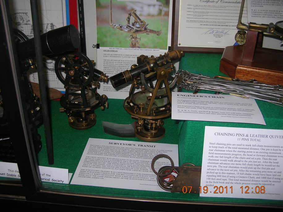
Photo #8
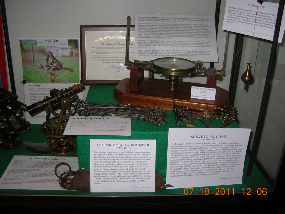
Surveyors Transit, Engineers (link) Chain (100ft.), Chaining (surveyors arrows) Pins,
Surveyors Vernier Compass, Surveyors (link) Chain (66ft.) Plumb Bob.
Township Plat
| Survey plats are part of the official record of a cadastral survey. Surveying is the art and science of measuring the land to locate the limits of an owner's interest thereon. A cadastral survey is a survey that creates, marks, defines, retraces or re-establishes the boundaries and subdivisions of Federal Lands of the United States. The survey plat is the graphic drawing of the boundaries involved with a particular survey project, and contains the official acreage to be used in the legal description. |
Photo #9
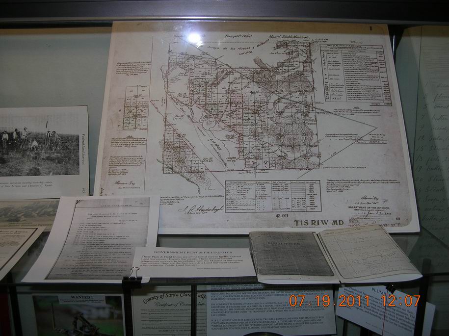
Township Plat ~ T1S, R1W, MD.
(read: Township 1 South, Range 1 West, Mount Diablo Meridian.)
To learn more about this Township Plat, visit our MDSHS maps page.
General Land Office (GLO) Township Plats Around The Mount Diablo Initial Point
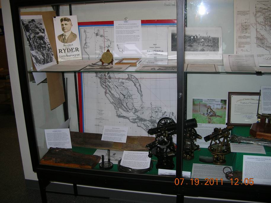
Mt. Diablo Initial Point
| The Mount. Diablo Initial Point was established on the "highest point" of the summit of Mount Diablo, located in Contra Costa County on, July 17, 1851 by General Land Office (G.L.O.) U.S. Deputy Surveyor Colonel Lender Ransom. It was used to control the majority of the PLSS surveys in California and all of Nevada. |
Photo #10
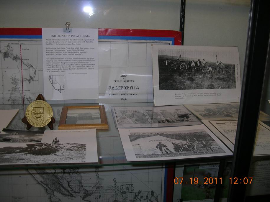
| Historic images of surveyors, historic photographs of the summit of Mount Diablo and the Initial Point. Photographs (circa 1908) of people standing on the top of the brick pier or "chimney" built over the "copper bolt" set by William Eimbeck of the U.S. Coast Survey in 1876 in the drill hole previously established by R.D. Cutts of the U.S. Coast Survey in 1852. (Note: This bolt is not the same as Ransom's Initial Point!) |
Irving L Ryder, County Surveyor.
Photo #11
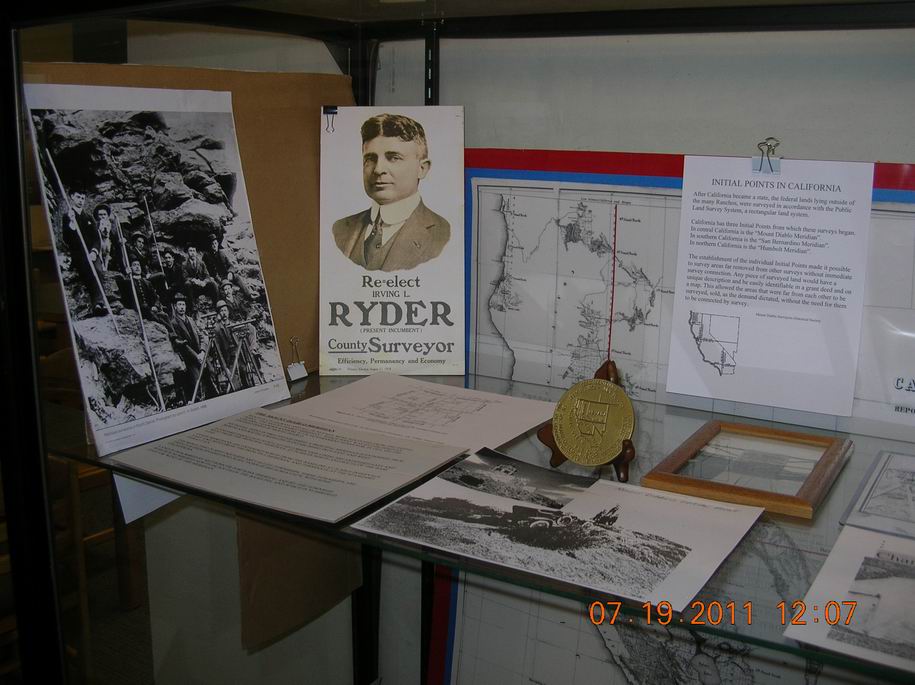
Re-elect Irving L Ryder (incumbent) as County Surveyor.
At one time in California, County Surveyors were elected officials.
Bearing Tree, Wood Post Monument
A Bearing Tree is an "Accessory" to a PLSS "Corner" marked in a specific manner per the
"Manual of Instructions" used to evidence the position of the corner monument.
Photo #12
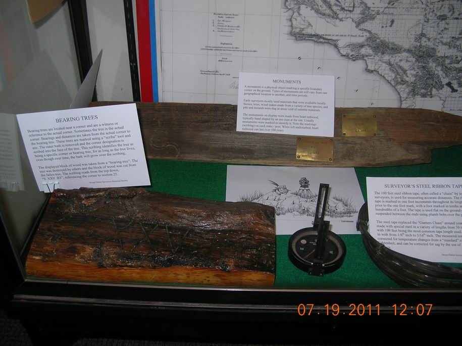
Bearing Tree, Wood Post Monument, Keuffel & Esser Surveyors Compass.
Transit with "Solar Attachment"
| The "American" style Surveyors transit contains a magnetic compass and is used for measuring both vertical and horizontal angles. Horizontal angels may be measured between objects by the use of the contained horizontal circle. By the use of the magnetic compass, bearings referenced to magnetic North may be established. With the use of a Solar Attachment, and observations of the Sun along with the use of astronomical tables, corrections to the magnetic bearings may be made to determine the "true" meridian. When the latitude and declination have been properly set off and the instrument so turned that an image of the sun is formed in a specified place, the main telescope of the transit will line in the meridian. The solar attachment here is of the Saegmuller type. |
Photo #13
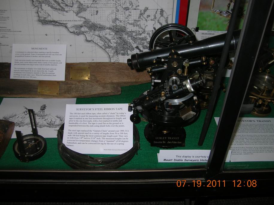
K&E Compass, Surveyors Steel Ribbon Tape, Surveyor's "Transit" with "Solar Attachment"
Transit is a W&L E Gurley, donated to MDSHS by local San Jose Surveyors; Earl & Gara Cross.
Engineers Link Chain
| An Engineers Link Chain is basically the same as a surveyor's chain except that it is 100-feet long, consisting of 100 "links", each being 12 inches long, and the wire used is usually, but not always, much stronger. The Engineer's Chain was used on construction projects, such as railroads, flumes, and roads. 50-foot engineer's chains were also manufactured. |
Photo #14
Surveyors Transits, Chaining Pins (steel arrows), Engineers Chain (100-ft / 100 links, 12 inches each).
Surveyors Link Chain
| *The Surveyors Link Chain was invented by Edmund Gunter (1581-1626). It was used for measuring distances, and was phased out of service around the end of the 19th century by the steel ribbon tape. A standard or common length of a chain is 66-ft (100 links, 7.92 inches each) but other lengths were commonly used such as a "half chain" of 33-ft (50 links, 7.92 inches each). |
Photo #15
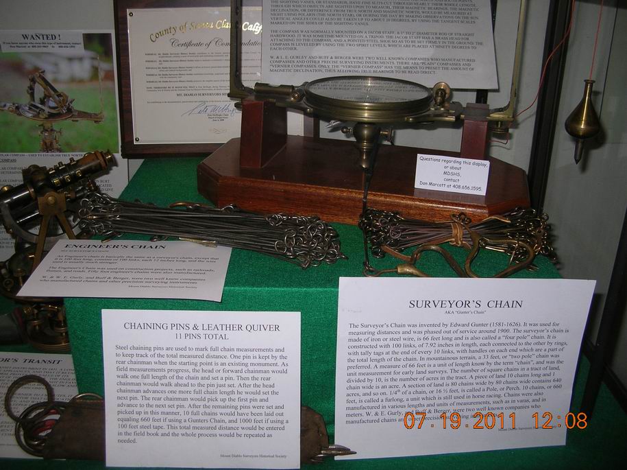
Chaining Pins (steel arrows), Engineers Chain (100-ft /100 links, 12 inches each),
Surveyors (Gunter*) Chain, Surveyors Vernier Compass.
| This display was mounted by Martin "Don" Marcott (retired SCCo. County Surveyor) of the Mount Diablo Surveyors Historical Society. Photographs by Don Marcott, ©2011 MDSHS. All rights reserved. |
MDSHS
is a California non-profit public benefit corporation organized under
IRS 501(c) (3) (Federal #8916806802, CA 1835904).
Website designed by and maintained by Michael J. Foley
Page last updated March 23, 2013
Copyright ©2013 MDSHS
http://www.mdshs.org