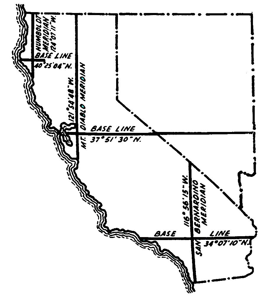
Map of the 3 Initial Points
Of the USPLSS for California and Nevada
and their Historic Latitude and Longitude Values
as published by the General Land Office
(1930 values)
History of the Image
This image is found throughout the Land Surveying and Real Property Law Professions as the starting points of all real property land descriptions based on the United States Public Land Survey System (USPLSS) within California and Nevada. The vertical lines are called "principal meridians" and the horiziontal lines are called "base lines". The three principal meridians in California are the "Mount Diablo" meridian" established on 1851, the "San Bernardino" meridian established on 1852 and the "Humboldt" meridian established on 1853. The Latitude and Longitude values shown are North from the equator and West of Greenwich, England values. The Mt. Diablo meridian controls USPLSS land descriptions within the central and northern portions of California and all of Neveda. The San Bernardino meridian controls USPLSS land descriptions within the southern portion of California and a small portion of land near Yuma, Arizona*. The Humboldt meridian controls USPLSS land descriptions within a small portion of northern California located along the coast.
*Source: Arizona Department of Revenue, Property Tax Division.
Source of the published Latitude and Longitude Values.
The values shown are as published in the;
Manual of Instructions for the Survey of the Public Lands of the United States (Page 138), issued June 14, 1930, by the Government Land Office and published by United States Government Printing office, Washington 1931.
Please scroll down to view a larger image.
Portions copyright © 1991 MDSHS, portions copyright © 1975, 1970, 1965, 1958 by PRENTICE-HALL, INC.,
Englewood Cliffs, New Jersy, other copyrights may apply including "Fair Use".
To find out about the current Lat/Long values for these three Initial Points and other Principal Meridians and Inital Points of the U.S. Public Land Surveys, visit our map page for the
Principal Meridians and Base Lines Governing The United States Public Land Surveys (including detail of the three California Meridians and Initial Points